Special Note - Grayson Highlands State Park/Mt. Rogers National Recreation Area
This is Virginia's high country - all between 4000 and 5700 feet in elevation. The Appalachian Trail guide to Southwest Virginia says that "the variety of terrain is unparalleled in the southern Appalachians ". The (northbound) trail through the area stretches from US 58 (near Summit Cut) to Fox Creek on VA 603, about 4 mile west of Troutdale, VA - a distance of 26 trail miles. This area is in Southwest Virginia, beginning just east of Damascus, VA.
The heart of this area is the 3.1 miles of the Appalachian Trail between Massie Gap in Grayson Highlands State Park and the Mount Rogers access trail. The AT (southbound from the .5 mile "Park service road" to Massie Gap) skirts around the northeast side of the large and striking rock outcroppings that make up Wilburn Ridge. It reaches Rhododendron Gap at 2.1 miles. There are also two other trails between Massie Gap and Rhododendron Gap, both of which parallel the AT. These are the Wilburn Ridge Trail which goes over the outcroppings and the Rhododendron Gap trail which skirts around the southwest side of the outcroppings (and is also a horse trail). Both are very appealing as well - and in combination with the AT make for a very nice loop (day) hike.
As the AT nears Rhododendron Gap, it passes through a small cave along the side of the last outcropping before the gap. The AT intersects the Wilburn Ridge Trail shortly after this cave, which makes it easy to get on the top of the last outcropping before Rhododendron Gap (turn left). This outcropping provides stunning views of Rhododendron Gap, which is a large area (acres) of Catawba (purple) Rhododendron. The flowers make the area very beautiful when the rhododendron is in bloom, normally around June 10. Backpacker magazine has featured this hike (at that time of the year) as one of their all-time best hikes.
There is a side trail to the north (of Rhododendron Gap) that passes between rhododendron bushes that tower over my 6' 3" tall frame. Another trail, the Pine Mountain Trail connects Rhododendron Gap to the Appalachian Trail at The Scales.
A bit less than a mile past Rhododendron Gap via the AT is the Thomas Knob Shelter. Shortly thereafter, there is a trail to the top of Mount Rogers, (5729'), which is the highest point in Virginia. It is .7 mile each way and is well worth the side trip. There are no views at the top, but the vegetation is characteristic of southern Canada, hundreds of miles to the north. The trees are Red Spruce and (the northernmost natural stand of) Fraser Fir. It is a very interesting mountaintop.
Little Pinnacle, Big Pinnacle - Extraordinary overlooks, located on the interesting trail between Massie Gap and the Grayson Highlands State Park Visitor Center: Thumbnails / Full-size
The Appalachian Trail (AT) traverses the area, running/winding southbound between VA 603, east of Konnarock and U.S.58 (near Summit Cut/east of Damascus, VA). Parking is available at Fox Creek, the AT intersection with VA 603.
The portion of the Appalachian Trail from Fox Creek (VA 603) to The Scales is mainly a woods walk. The trail passes through the Lewis Fork Wilderness Area, passes Old Orchard Shelter and an intersection with the Pine Mountain Trail, then reaches The Scales at 4.7 miles (from VA 603). The trail then ascends and crosses Stone Mountain, then drops back down and passes the Wilson Creek Trail and Big Wilson Creek. It crosses into Grayson Highlands State Park near the Wise Shelter and then winds through Grayson Highlands State Park for 2 miles, reaching the "Park service road" to Massie Gap at 9.8 miles from Fox Creek.
The section of trail from the Grayson Highlands State Park boundary to Massie Gap passes through two very nice sections of Rose Bay rhododendron, one of them very close to the Wise Shelter, the other at a stream crossing in the middle of the section. In late July 1997, when I walked this section, these Rose Bay rhododendron bushes were covered profusely with blossoms. On that same hike, I had passed through a similar area about three quarters of a mile from the campground (Grayson Highlands State Park). Around 2015, I went back to that area and found the rhododendron bushes dead, not even any leaves…, just bare branches. I've not been back to the two areas along the Appalachian Trail, but wonder if they may have experienced the same fate (hopefully not).
Then, (detailed above), comes the heart of the area, which is the 3.1 miles of the Appalachian Trail between Massie Gap in Grayson Highlands State Park and the Mount Rogers access trail.
Elk Garden - The Appalachian Trail crosses VA 600 here - large open field.
Whitetop Mountain - 5520' - Second highest point in Virginia and (high on its side), Buzzards Rock - 5080'. Both are also accessible by road from VA 600.
U.S.58 (near Summit Cut/east of Damascus, VA). Parking is available here?
The Trails... (additional note): - A lot of variety, including many rocks, but generally not particularly difficult.
Access: The entrance to Grayson Highlands State Park is on U.S.58 about 9 miles west of Volney. There is a large parking area along the park road at Massie Gap and a backpacker parking area nearby - on the left side of the road that leads to the campground. This is all several miles from U.S. 58 inside Grayson Highlands State Park. A 1/2 mile trail across the meadow from the Massie Gap parking area connects the park road to the AT.
Little Pinnacle: When you visit Grayson Highlands State Park, don't miss Little Pinnacle. This is an astounding overlook at the top of the park. Continue to the end of the park road (at the Visitor's Center). Even if it's not open, walk around the left side of the building and follow the trail you find. When you get to a T, turn left and follow the trail for about 1/2 mile. Little Pinnacle will be on the left. This rock is at an elevation of approximately 5100'. The view from this point is one of my all-time favorites. To the right you can see Mount Rogers and Wilburn Ridge. Straight ahead you can see US 58, several tree farms and a few houses. But mostly you'll see the wooded hills, mountains and beautiful sky of 3 states - Virginia, North Carolina and Tennessee. Further on is Big Pinnacle, which gives a nice view of Wilburn Ridge. And then the trail loops back to the T. These high points can also be reached by trail from Massie Gap - just cross the road from the parking area and follow the steep trail to Big Pinnacle, then on to Little Pinnacle.
When to visit? The elevation at Massie Gap is above 3500' and most of the trail in this section is between 4000' and 5200' in elevation. Winter comes early and lasts a long time at these elevations. But it's the nicest place in the state to be when the temperature is hot - i.e. mid-summer. My favorite time is early June when the Rhododendron is in bloom. There is a campground in Grayson Highlands State Park at 3500', close to Massie Gap. This makes it easy to spend time at the cooler high elevations at/above 3500' when it is unpleasantly hot in the cities, and at the lower elevations of the state and region.
It's been a source of great joy and satisfaction to hike the Appalachian Trail, as well as the other high country trails (especially Wilburn Ridge, Rhododendron Gap, Pine Mountain and Pinnacles) in Virginia's High Country. It is my favorite area in the Eastern United States. Though I have not yet completed the entire Appalachian Trail, I do not expect to find another area with the overall appeal of this one. Enjoy!!! - Upward Call
Rhododendron Gap along and/or near the Appalachian Trail in the Mount Rogers National Recreation Area when the Rhododendron is in bloom.
Thumbnails
Click the Thumbnail to "enlarge" the image. it will open in another tab. Use the back button to return to the Thumbnails (it will also close the tab).
OR
Click the number at the bottom of the Thumbnail to go to the image (full-size) in the section below all the thumbnails. Use the back button to return to the Thumbnails.
Rhododendron Gap - Full-size photos along and/or near the Appalachian Trail in Mount Rogers National Recreation Area, most when the Rhododendron is in bloom.
Little Pinnacle - Photos from along the trail to and views from Little Pinnacle, with a few from Big Pinnacle (I think) - trail starts behind the left side of the Visitor Center at Grayson Highlands State Park.
Thumbnails
Click the Thumbnail to "enlarge" the image. it will open in another tab. Use the back button to return to the Thumbnails (it will also close the tab).
OR
Click the number at the bottom of the Thumbnail to go to the image (full-size) in the section below all the thumbnails. Use the back button to return to the Thumbnails.
Little Pinnacle - Full-size photos from along the trail to and views from Little Pinnacle, with a few from Big Pinnacle (I think) - trail starts behind the left side of the Visitor Center at Grayson Highlands State Park.
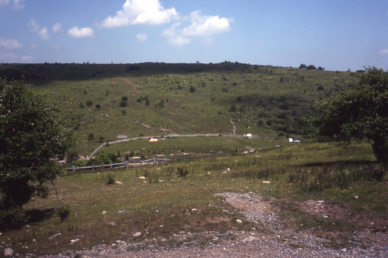
Appalachian Trail - Photos of the Appalachian Trail in Grayson Highlands State Park and the Mount Rogers National Recreation Area.
Thumbnails
Click the Thumbnail to "enlarge" the image. it will open in another tab. Use the back button to return to the Thumbnails (it will also close the tab).
OR
Click the number at the bottom of the Thumbnail to go to the image (full-size) in the section below all the thumbnails. Use the back button to return to the Thumbnails.
Photos of flowers... in Grayson Highlands State Park and Mount Rogers National Recreation Area.
Thumbnails
Click the Thumbnail to "enlarge" the image. it will open in another tab. Use the back button to return to the Thumbnails (it will also close the tab).
OR
Click the number at the bottom of the Thumbnail to go to the image (full-size) in the section below all the thumbnails. Use the back button to return to the Thumbnails.
Photos of plants and trees... in Grayson Highlands State Park and Mount Rogers National Recreation Area.
Thumbnails
Click the Thumbnail to "enlarge" the image. it will open in another tab. Use the back button to return to the Thumbnails (it will also close the tab).
OR
Click the number at the bottom of the Thumbnail to go to the image (full-size) in the section below all the thumbnails. Use the back button to return to the Thumbnails.